Drone Flight at Franklin Mountains State Park in El Paso, Texas
Low aerial view of North Franklin Mountain, the highest point in Franklin Mountains State Park
Franklin Mountains State Park - El Paso, Texas
Franklin Mountains State Park is one of the largest urban state parks in the United States, located entirely within the city limits of El Paso, Texas. Stretching over 27,000 acres, the park lies along a rugged section of the Franklin Mountains and offers visitors hiking, mountain biking, rock climbing, and scenic drives. It features multiple trailheads, a visitor center, and panoramic views of the Chihuahuan Desert landscape. The park provides a gateway to exploring the unique geology, flora, and fauna of this mountainous region of far West Texas.
Getting to Franklin Mountains State Park from El Paso
Franklin Mountains State Park is easily accessible from various parts of El Paso, as the park lies entirely within the city limits. One of the main entrances is at the Tom Mays Unit, located off Transmountain Road (Loop 375). From downtown El Paso, it takes about 20 minutes to drive to the Tom Mays Unit by heading north on I-10 and then west on Loop 375. Other access points to the park include the Smuggler’s Pass trailhead along Transmountain Road and several smaller trailheads in residential areas on both the east and west sides of the mountains. Parking is available at most major trailheads, and clear signage helps direct visitors into the park.
Flying a Drone in Franklin Mountains State Park
Permit Required: Yes.
Permit Cost: $0
When I began traveling to capture drone footage, I was frustrated by the restrictions on flying in national parks. But I’ve found that many state parks allow it, and some of my best flights so far have been in state parks in Utah and, to a lesser extent, Colorado. I was looking forward to visiting El Paso and was glad to learn that drones are allowed in Franklin Mountains State Park.
You can register at the park headquarters when you pay your entry fee. The main entrance is at the Tom Mays Unit. Entry is $5, and the drone permit is free. You’ll need to fill out a short form. The rangers were helpful and asked a few questions, including whether I posted my footage online.
I visited the park on two different days to fly.
The first day was during the week around midday. My first couple of days in El Paso had poor visibility—white and gray skies, strong wind, and sandstorms. When the third day finally brought clear skies and the mountains were visible, I finished my work early and headed straight to the park.
After registering, I walked up the road to get familiar with the area. The park is part of a dry desert landscape several miles east of the Río Grande, which was already dry during my visit in early March.
Even in the arid environment, there’s a lot of color: red rock formations, green and yellow cacti, yucca, and other desert plants.
Flying the drone gave me a clear view of the Franklin Mountains, including North Franklin Mountain—the highest peak in the range, not far from the park HQ. It’s hard to get a full panorama of the range from one spot, but you can see far in all directions.
To the north are the Organ Mountains in southern New Mexico. To the east is part of the White Sands Missile Range.
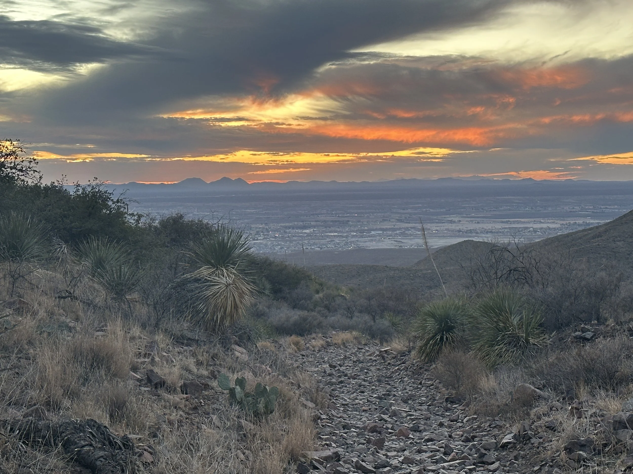
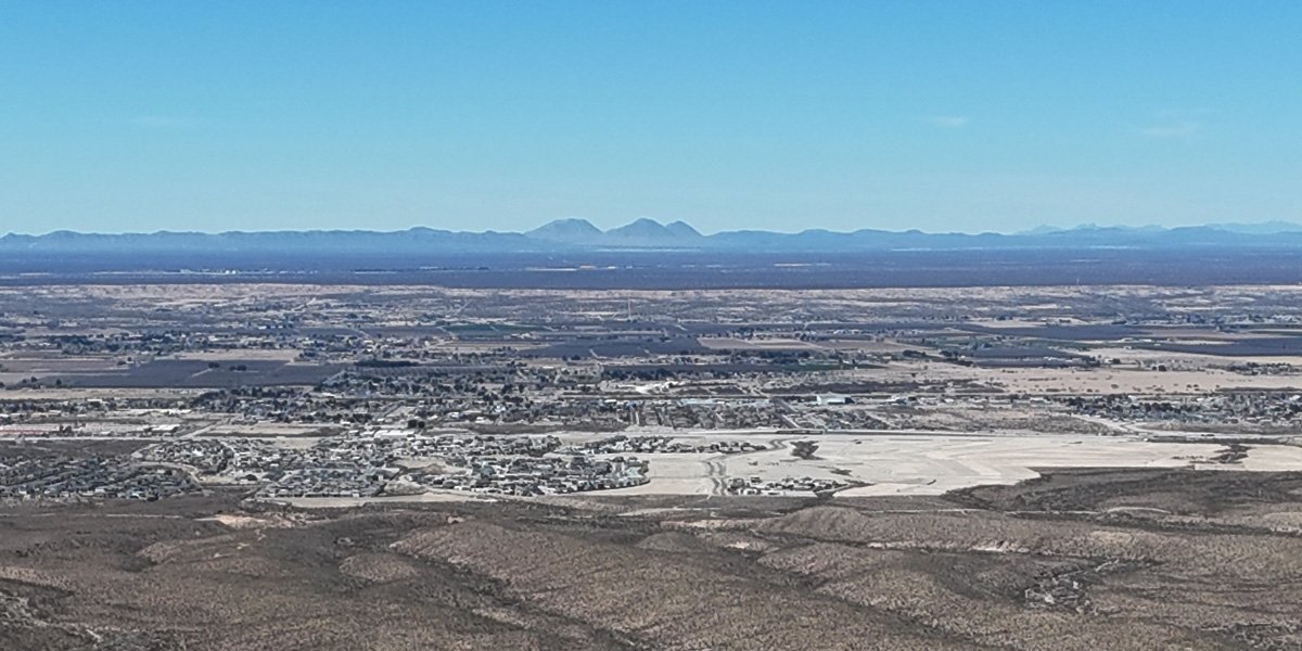
Looking west, you can see across the west side of El Paso and into southern New Mexico, including the East and West Potrillo Mountains.
West El Paso fades into the open desert of southern New Mexico. In the distance, the Potrillo Mountains rise from the Chihuahuan Desert floor—part of a remote volcanic field just north of the U.S.–Mexico border.
To the south, you get a view of Ciudad Juárez, across the border in the Mexican state of Chihuahua.
The larger range is the backdrop of Juárez. The closer, smaller range is Sierra de Cristo Rey. The range is where Texas and New Mexico meet the border with Mexico. There is a 29’ limestone statue of Jesus atop the range.
I also hiked up to Mundy’s Gap, one of the park’s permitted drone launch areas. From there, you can see east El Paso, including Fort Bliss and some smaller ranges. I had hoped to spot Guadalupe Peak, the highest point in Texas, but it’s not visible from here.
East El Paso and Fort Bliss from Mundys Gap in the Franklin Mountains.
My second trip to the park was on a Sunday morning. It was hot and clear. There were a lot more people this time, but there’s plenty of space in this large, rugged mountain park. It’s nice to talk to people, but it’s also easy to find space to fly without being a burden—or being burdened.
Final Thoughts on Flying a Drone in the Franklin Mountains
Traveling to an urban mountain park like Franklin Mountains State Park gives you quick access to a remote, rugged environment without leaving the city. The permit process is simple, free, and handled on-site. With wide-open space, dramatic terrain, and views that stretch across Texas, New Mexico, and into Mexico, it’s a great place for drone flying. Overall, this is one of the more accessible and rewarding locations I’ve flown in.


